72 Federal
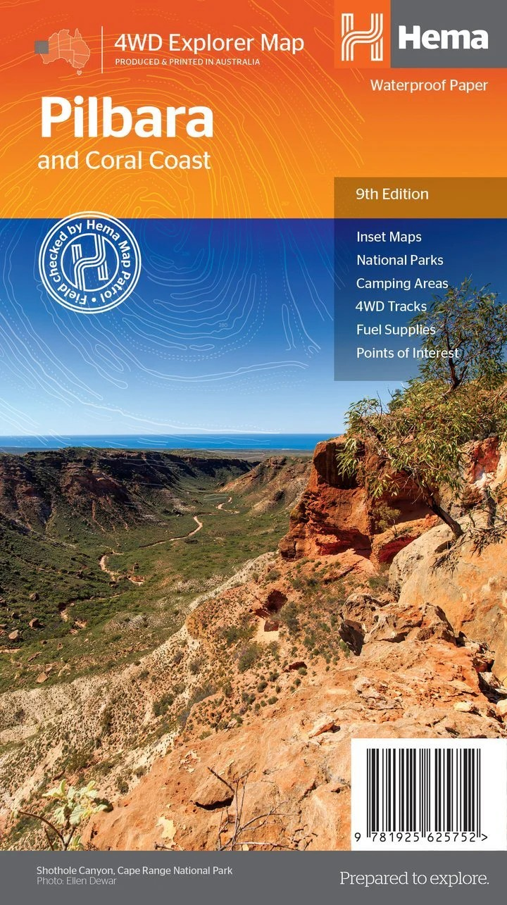
Pilbara And Coral Coast
Pilbara And Coral Coast
Couldn't load pickup availability
Hema Pilbara and Coral Coast Map (9th Edition)
Discover the rugged beauty of WA’s northern frontier
This waterproof, regional touring map covers the spectacular landscapes and diverse ecosystems of the Pilbara and Coral Coast – from the marine wonders of Shark Bay and Ningaloo Reef to the dramatic gorges of Karijini and historic Marble Bar.
Designed for travellers and adventurers, the map includes GPS-surveyed roads, essential travel facilities, and expert local insight. It’s the perfect companion for caravanners, 4WD explorers, and those seeking out Western Australia’s rich natural and cultural heritage.
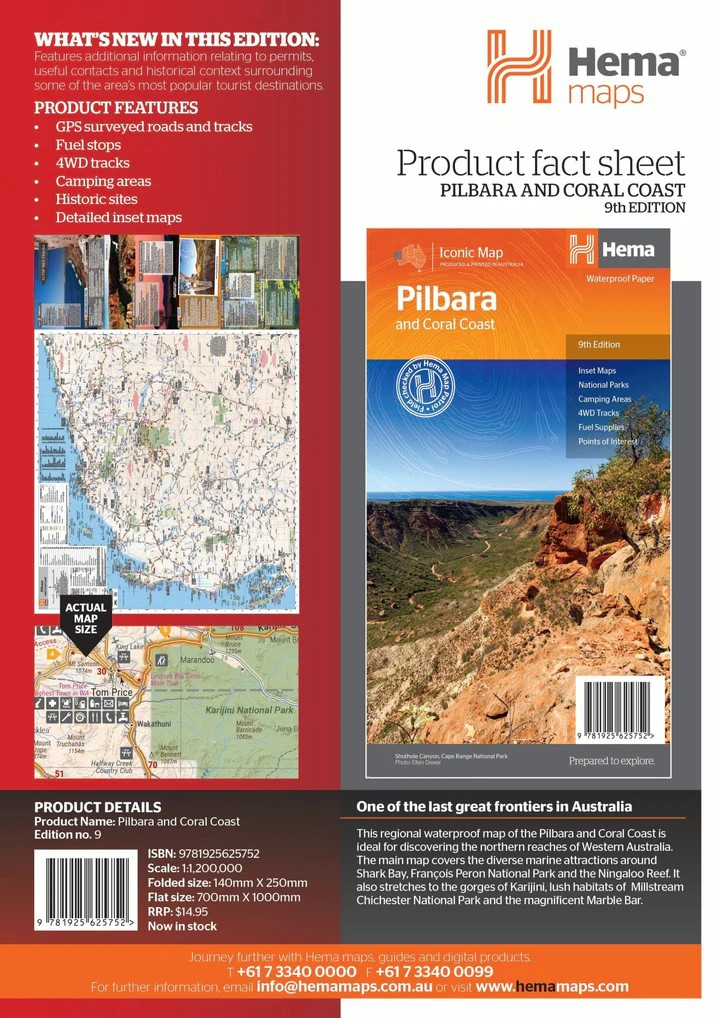
Key Features
- Covers the full stretch of the Pilbara and Coral Coast
- GPS-surveyed roads and 4WD tracks for accurate travel planning
- Highlights key regions including Shark Bay, Karijini, Millstream Chichester NP, Marble Bar, François Peron NP, and Ningaloo Reef
- Detailed inset maps of high-interest areas
- Locations of fuel stops, camping areas, and key historic sites
- Useful travel contacts and permit information included
- Waterproof and tear-resistant paper for durability in the field
Key Specifications
- Edition: 9th
- Publication Date: 15/04/2019
- Scale: 1:1,200,000
- Folded Size: 140mm x 250mm x 2mm
- Flat Size: 700mm x 1000mm
- Weight: 0.06kg
Printed in Australia, this map is ideal for those ready to journey through one of the country’s most breathtaking and remote regions. Whether you're planning a scenic coastal drive or an inland 4WD expedition, this map will guide you every step of the way.
Share