

72 Federal
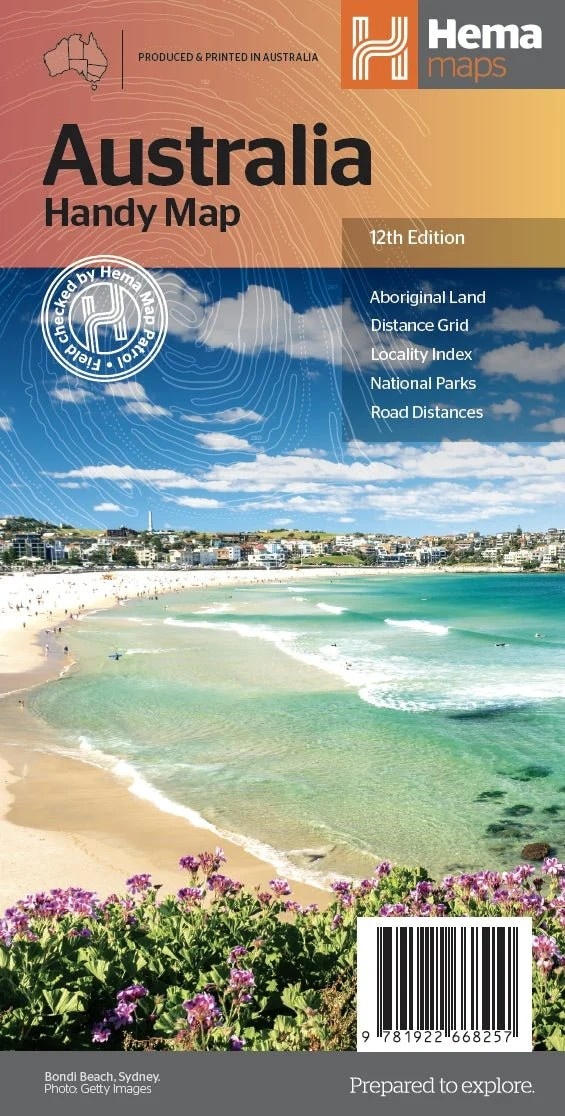
Australia Handy Map
Australia Handy Map
Couldn't load pickup availability
Hema Australia Handy Map (12th Edition)
Compact. Practical. Essential for Australian Travel.
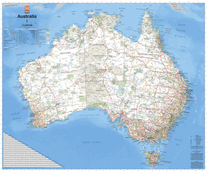
The Hema Australia Handy Map is a foldable, lightweight map designed for practical travel use. Perfect for journey planning, this map includes national parks, major road networks, distances, and city access routes. It’s a great glovebox companion or reference tool at home or on the road.
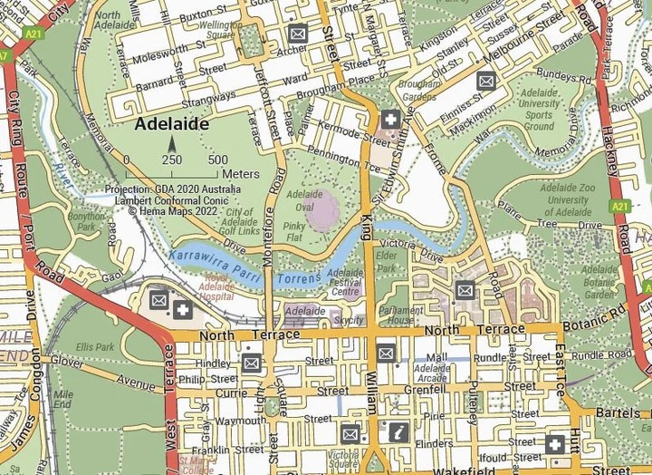
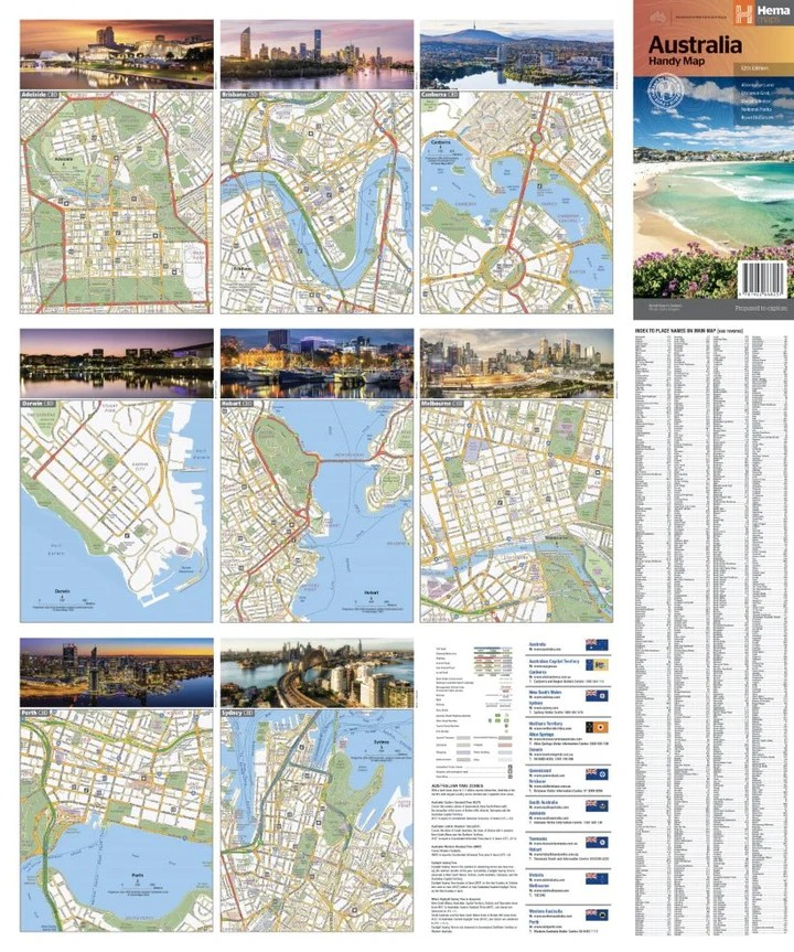
On the reverse, you’ll find detailed CBD maps of all major capital cities—Brisbane, Melbourne, Sydney, Canberra, Darwin, Adelaide, Perth, and Hobart—plus a comprehensive distance chart and full placename index for easy navigation.
Key Features
- Hema’s iconic, easy-to-read map of Australia
- Compact foldable design for on-the-go reference
- Capital city CBD maps for all major cities
- Marked national parks, indigenous lands, and road distances
- Distance grid and full placename index
- Ideal for road trips, caravanners, tourists, and educators
Specifications
- Edition: 12th
- Publication Date: 01/10/2022
- Scale: 1:6,500,000
- Folded Size: 125mm x 250mm x 3mm
- Flat Size: 625mm x 750mm
- Weight: 0.06kg
- Printed in Australia
Whether you're planning your next big road trip or just want a reliable national overview at your fingertips, the Hema Australia Handy Map is a smart, space-saving choice.
Easy to use. Easy to carry. Made for real adventures.
Share